![]()
Cycling Mt. Baker
Ride 24 miles gaining 4,679’ at 3.3% average grade.
Photo: Stacy Topping one mile up, 24 to go!
Mount Baker is located in the North Cascades of Washington State and offers cyclists a challenging and scenic ride up to the end of Mount Baker Highway (State Route 542). The annual Mt. Baker Hill Climb takes place here on the fourth Saturday of September, starting in Glacier and covering a 24-mile ascent to scenic viewpoint Artist Point with views rivaling Glacier National Park.
![]()
![]()
Scenes along the first half of the climb.
This scenic northern Washington bike climb begins in Glacier, WA (population 211 in 2010) by riding east on Highway 542. Glacier is the community closest to Mt. Baker, the northernmost mountain of the Cascade volcanoes, which stretch as far south as Lassen Peak in northern California and also include Mt. Shasta, Mt. Hood and Mt. Rainier. Mt. Baker is 10,781’ and was first summitted by Edmund Coleman on August 17, 1868.
![Mt. Baker Climbing Mt. Baker by bike - view of Mt. Baker across the Salish Sea]()
Mount Baker as seen from the Salish Sea near Port Angeles, WA (on our Hurricane Ridge cycling trip).
While the average grade of the Mt. Baker climb is only 3.3%, the steepest mile begins at mile 1.4 (9%) and the steepest five mile stretch begins at mile 12.7 and continues almost to the top, averaging 6.2%.
![]()
Drone photo of Mt. Baker taken near the beginning of the climb.
![]()
Ride near or along the North Fork Nooksack River from miles 2-7
“The Mt. Baker-Snoqualmie National Forest is one of the most visited forests in the country. Located on the west side of the Cascades between the Canadian border and Mt. Rainier National Park, you will find glacier-covered peaks, spectacular mountain meadows and old-growth forests rich in history and outdoor opportunities.” fs.usda.gov
![]()
Scenes along the second half of the climb.
![]()
Mt. Baker Ski Resort and Raven’s Hut at ~mile 19
Before heading to Washington on your Mt. Baker cycling adventure, be sure to rely on our list of Things to Bring on a Cycling Trip, and use our interactive checklist to ensure you don't forget anything.
![Mt. Baker Bicycle climb Mt. Baker - pond near Chain Lakes Trailhead]()
Pond at the Chain Lakes Trailhead -- mile 22.
![]()
![]()
Fantastic scenery along the climb.
Mt. Baker in background top photo.
![]()
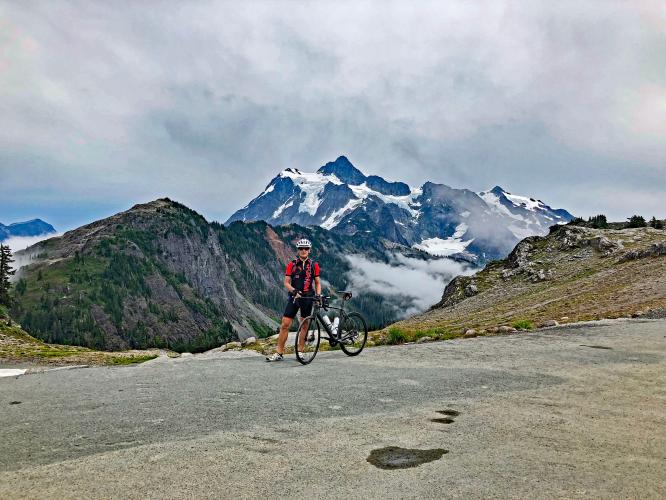
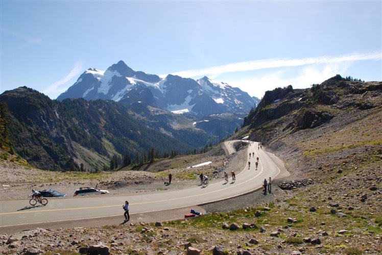
Mt. Shuksan is a prominent peak to the east as we climb
Mt. Shuksan is another scenic peak along our climb. It can be mistaken for Mt. Baker, but just keep in mind that Shuksan is 2 peaks with minimal snow and Baker is one snow covered peak. Also, Shuksan is east and Baker southwest as we climb. Both are visible at the finish - Baker by walking just a bit up the paved trail at the finish of the climb.
![]()
Near the finish.
![]()
July 11, 2021
![]()
![]()
Finish
![Mt. Baker Biking Mt. Baker - Stacy Topping and Bruce Hamilton of PJAMM with bikes at Artist Point with Mt. Shuksan in background]()
Climb ends at Artist Point -- Mt. Baker in the background (peak 10,781’’).
Southwestern view from Artist Point of Mt. Baker.
Thank you Bruce Hamilton and Stacy Topping!!
CHAIN LAKES LOOP TRAIL
![]()
6.5 miles, 1,820’ elevation gain
An excellent way to see Mt. Baker from a hiking trail is Chain Lakes Loop Trail:
Chain Lakes Loop Trail is a 6.5 mile heavily trafficked loop trail located near Concrete, Washington that features a lake and is rated as moderate. The trail is primarily used for hiking, camping, and backpacking and is best used from June until October. Dogs are also able to use this trail but must be kept on leash. AllTrails - Chain Lakes Loop Trail
The trailhead is at the finish of the climb, at Artists Point.
![]()
![]()
![]()
![]()
![]()

 We've partnered with Sherpa-Map.com to bring you the best route planning tool. With a PRO Membership you can use this climb as a reference when creating your route.


